
Nome, Alaska
USA.
N 64 º30.082’
W 165 º25.199’
| News |
| Sunday 8th March |
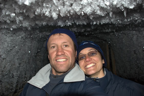
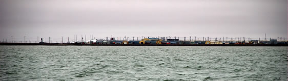
As we deal with heat waves and wild weather in Melbourne, Tyhina is slowly being hidden in an ever deepening snow drift. Pat has just sent through the latest photos of Tyhina as she sits on the hard stand in Nome. |
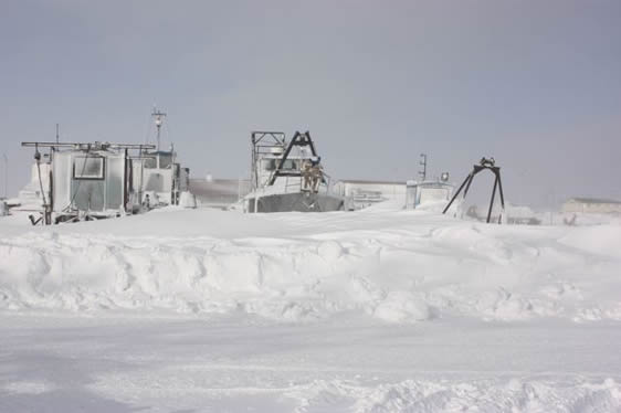 |
Spring in Nome (Photo: Pat Hahn) |
| Tuesday 30th September 2008 |
| Tyhina - Nome, Alaska |
| Maeva and Pete - Melbourne, Australia |
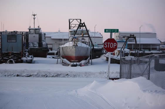 |
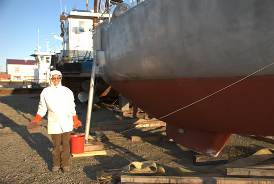
Tyhina on the hard stand in Nome Jan 2009 (Photo: Pat Hahn) |
We are now back in Melbourne after a successful summer of sailing. Tyhina waits patiently for us under the watchful eye of our friend Pat Hahn. We met Pat through Peter Semotiak our ice and weather router. Upon hearing of our arrival in Nome harbour Pat came down to the boat and invited us back to his house to for lunch and a long overdue shower. This turned into an overnight stay at the Old Point Nome Roadhouse which is about 20 miles out of Nome and owned by the Hahn family(see photo's below). Pat grew up in Nome and is also a Northwest Passage maker, only he did it in an umiak (an open walrus skinned boat) in the late 70's with much more ice and far less support. He has worked, fished, skied, hiked and sledded around Nome all his life and has a library on Arctic travel and exploration that is incredibility extensive and probably the envy on many institutional libraries around the world. As I finished up winterizing Tyhina, Maeva spent many hours in Pat's library looking at original editions of Amundsen, Franklin, Parry and Stephenson’s expedition journals. When I was researching our trip I often went to the rare book section of the State Library in Melbourne, where I was able to read some of these in the controlled atmosphere of the rare book room. At Pat's they can all be enjoyed with a cup of coffee and sandwich. When we lifted Tyhina out of the water after 10 days of winterizing, cleaning and stowing it was our first chance to access the damage sustained to the keel when we touched bottom at Herschel Island. Much to our relief this turned out to be gravel wedged between the centreboard and the keel envelope. After a bit of delicate work with a hammer and screw driver we managed to free the centreboard. If only Maeva had dived on it in Herschel Island we could have avoided all that rolling!! |
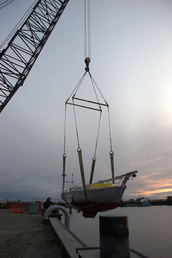 |
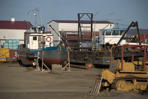
Haul out at the Nome small boat harbour |
 |
Maeva ready to scrub the hull |
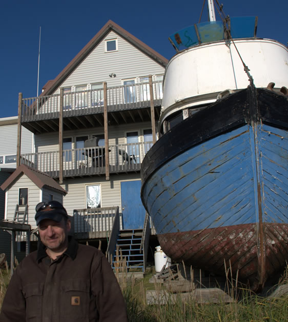 |
Pat Hahn in front of his home in Nome |
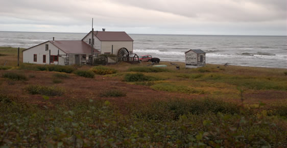 |
The old Point Nome Roadhouse, now owned by the Hahn family |
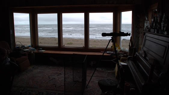 |
The view from the lounge room at Point Nome |
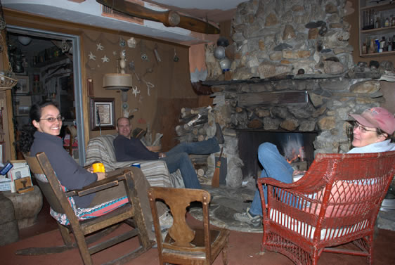 |
Relaxing in front of the open fire - Point Nome |
 |
Tyhina waits for our return next summer |
| Wednesday 17th September |
| Nome, Alaska |
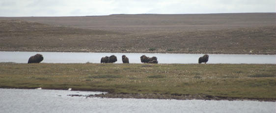
Well we have made it. A few nights ago we arrived in Nome, Alaska where we will haul out for the winter. When we left you last time we were in Cambridge Bay, pretty much the half way point our journey. Our last night of sailing into Cambridge Bay we had pushed into head winds and these continued for the next few days so we enjoyed an extra day of rest in CB, hired a car and headed out of town to try and see some muskox. Under strict orders from the rental car company manager we stayed on the “main” road, (apparently he has to go an rescue quite a few of his customers who do not abide by this rule) but we did literally drive to the end of the road where is just dissipates into open tundra. After a walk of about an hour across the tundra and a few streams we were able to get pretty close to a small herd of muskox, once they spotted us they bunched up and with their young protected behind them and the dominant male patrolling back and forth looking a little annoyed at our presence. Muskox will generally retreat when threatened, unless cornered, when they will charge! As we were approaching them on a small peninsula we were careful to give them ample room to make their escape; however they were happy to just close ranks and observe us as we observed them. |
|
Muskox - near Cambridge Bay |
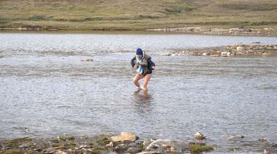 |
Maeva negotiating a stream |
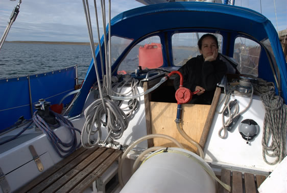 |
Maeva loves refuelling or perhaps she's still annoyed about the river crossing pic! |
We departed Cambridge Bay early on the 23rd of August, the forecast was for variable winds however these were more south westerly than anything else so we tacked back and forth down Dease Strait. Late in the afternoon the wind dropped out and we motored in dead calm conditions through the night and most of the following day. That evening the breeze returned and we rounded Lady Franklin Point on a 15 knot easterly, as I planned the trip in 2006 I had imagined that Franklin would have named an impressive landmark after his wife. Lady Franklin Point is however a low featureless point that is hard to distinguish as it runs into the sea - quite uninspiring really. However it does mark the point where the NWP begins to open out into Amundsen Gulf through Dolphin and Union Strait - we were now entering the Arctic Ocean. Later that night as we made our way to the abandoned settlement of Bernard Harbour to seek shelter from a building gale we had our first brief taste of the northern lights (more on these later). We sheltered in Bernard Harbour for two days, the direction of the wind meant that the anchorage marked on the chart was exposed, however we were able to sneak in between a small island and shallow indentation in the mainland that had a sand spit running off of it. Although it offered little protection from the wind, the low spit gave us calm waters and good holding in 8 feet of water. We passed the time reading, cooking and watching DVD's from Tyhina's extensive library of 3 DVD's. |
|
Lady Franklin Point |
|
Bernard Habour in the protection of the spit |
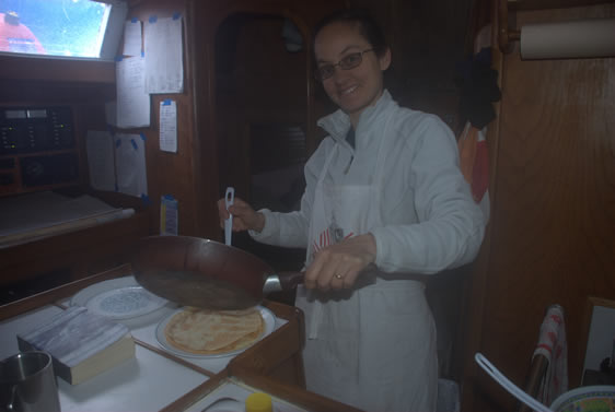 |
Crepe anyone? |
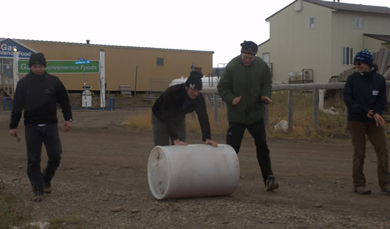
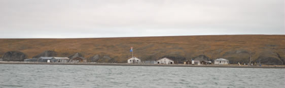
The wind had dropped back to 25 knots by the morning of the 27th and we motored out into a steep 5 - 6 foot chop at the entrance of Bernard. Once clear of the harbour entrance we set 3 reefs and a corner of headsail and were soon making 7 ½ knots, abeam Cape Bexley by noon and Dolphin and Union Strait was behind us, Cape Parry the next day and the following morning (Friday 29th Aug) we rounded Cape Bathurst and Observation Point on Baillie Island, Amundsen Gulf now behind us. We had planned to sail through Snowgoose Passage which runs between the mainland and the Baillie Islands however the seas were up at the entrance and visibility was low, so we continued on our way. The temperature took a bit of a tumble about this time, as we neared the polar pack which was sitting about 20 miles to our north. We had been enjoying balmy 5ºC days for the past week but the daily high dropped to around 2 ºC as we entered the Beaufort Sea and approached Tuktoyuktak. 24 hours after rounding Cape Bathurst we were alongside at the small boat pontoon in the centre of Tuk, 0830 not a soul in site, snowing - temp 0ºC. We thought we must have our watches set to the wrong time zone, but people tend to start and end their days later to take advantage of the “warmer” parts of the day. Baloum Gwen and Southern Star who we had also seen in Gjoa Haven had arrived the previous day were tied up to the main jetty. A public holiday in Tuk meant no fuel deliveries to the dock. As we had used up the last of our fuel from the 44 gallon drum lashed in the cockpit we gave it to the boys on Baloum Gwen who rolled it back and forth between the fuel station and their boat all afternoon to refuel. Although we had a fairly brief stay in Tuk we packed a lot in, we met the mayor, who told us about the problems that the town is having with erosion; were shown through the community freezer, which is a series of tunnels dug into the permafrost 20 feet below ground; Maeva was interviewed by a French TV Documentary crew and we climbed some pingos. Pingos are large frost mounts up to 150 feet high, Tuktoyuktak is the pingo capital and has a pingo national park nearby. The mouth of the McKenzie river also enters the sea near Tuk, this provides a huge amount of drift wood which washes down the river each spring – the locals use this for building and as a fuel source, as we have been north of the tree line for some time this was the first timber we had seen since leaving Newfoundland. |
|
The small boat wharf - Tuktoyuktak |
|
20' below and 10 below freezing in the Community Freezer |
|
The boys from Baloum commandeer our fuel drum. |
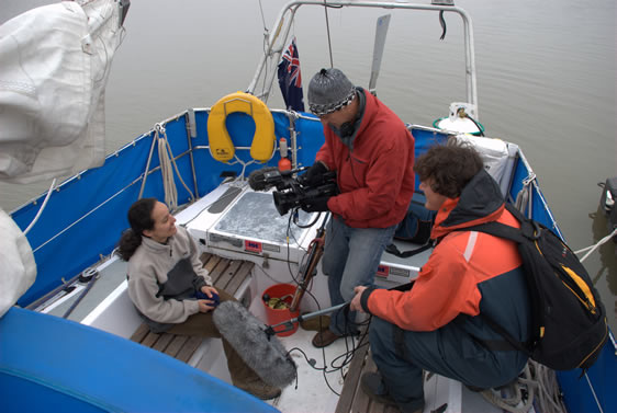 |
Maeva being interviewed by French Documentary Crew |
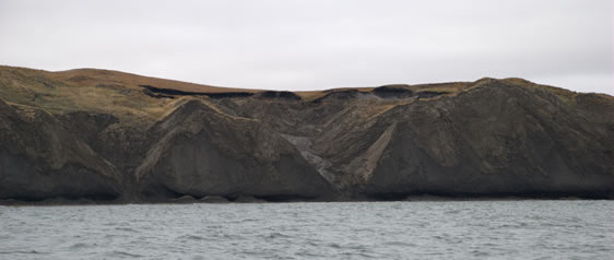
On our way again late on Sunday 31st of August, Herschel Island our next stop. We arrived late on the September 1st a light easterly breeze at our back and flat seas, perhaps we had relaxed a bit too much, as we rounded up to take down the main we ran onto a sand bank and damaged the centreboard causing it to become jammed in the up position. Herschel Island has a constant stream of scientists visiting and staying at the community hut – studying everything arctic from sea ice to lemmings. We met the latter; two biologists staying for a month to study these cute little rodents. Due to the damaged keel we decided to get underway after only a brief stop, with keel in the up position Tyhina would be less stable and would not be able to point as well up wind. The forecast for a following breeze would allow us to make a fairly direct route to Barrow and avoid the pack ice and bergy water that was less than 20 miles off the coast. From Herschel to Barrow there is not much to report we sailed in 20 to 25 knot easterlies, and although the ice edge and bergy water were close to our north we did not see any ice, just felt its effects with temps in the -2 to +1 ºC range. Winter was not far behind us, whalers early last century always planned to round Point Barrow and be on their way south by September 1st as this marked the start of worsening weather and the pack often closed in on Point Barrow around this time. We planned to anchor in the lagoon on the east side of Point Barrow and dive on the keel to assess the damage and to see if we could do anything to get it to come down. When we reached the lagoon entrance at daybreak on September 4th a 6 foot sea was running behind us and the entrance to the lagoon was obscured by breakers. After a number of trips up the mast to try and find a way through we decided to continue on and put up with the rocking and rolling. |
|
Herschel Island - Rangers Quarters |
|
Permafrost erosion Herchel Island |
We rounded Point Barrow and entered the Chucki Sea at midday in light snow, the easterly winds continued and this made for some very nice sailing in relatively flat water in the lee of Point Barrow. September 5th, Icy Cape was icy cold – water temp at 0.8 ºC and air temp at minus 2 ºC, but no sea ice. The ice chart had show a large field of 6/10 ice slowly closing in on the coast in this region, the colder waters that we were experiencing were an indication of its presence as was the white line on the horizon to our west. Icy Cape was our last danger point from an ice point of view, so now the ice was behind us, only open water ahead. Less than 24 hours later we were 5 miles off Cape Lisbon and motoring in flat seas with no wind. The forecast was good for the coming days – northerly winds all the way to the Bering Strait; the finish line was in sight. I suppose at this stage my superstitions got the better of me, in the calm seas we shut down the engine, did an oil change, oil filter change, fuel filter change and replaced the alternator belt and sea water pump belt – I was not going to be having some mechanical failure so close to the end. We carry a fair range of spares on board, as well as consumables for scheduled maintenance – such as oil changes which I do every 50 hours of running time – this has seen us free of engine problems for the entire trip despite the engine being 25 years old and having more than 10000 hours running time; thankyou Yanmar, keep up the good work. After passing Icy Cape the sea temperature increased rapidly, on the afternoon of the 6th of September abeam Point Hope our water temperature was 9.1ºC, a 15 knot northerly wind arrived at about 10 pm that evening and we set full sail although our progress was slowed by what the locals call the Japan current which brings warmer waters from the south. |
|
Barrow |
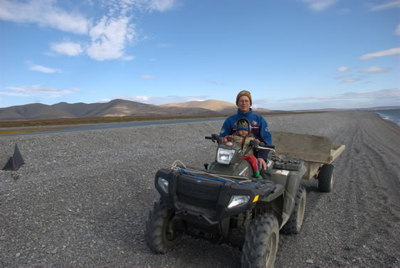
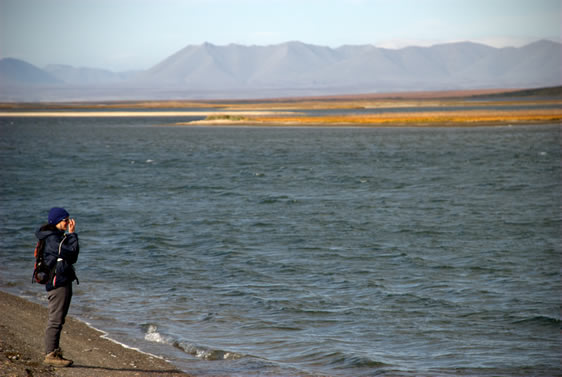
On the 7th of September at 1540 AKDT (Alaskan Daylight Time) Tyhina re-crossed the Arctic Circle heading south, 51 days since its northbound crossing off the coast of Greenland in July. Standing at the back of the cockpit facing north – I bowed and thanked Neptune for being so kind and the Arctic for giving us so much. But the journey was not over yet, 46 miles to the Bering Strait and a line on the chart between Cape Prince of Wales and Little Diomede Island that would close the chapter on the Northwest Passage for Tyhina. Up until now Jim the autopilot had been doing the steering, however the quartering seas had slowly increased as had the winds, now NW 30 knots and he was unable to cope with waves of 8 to 9 feet, so it was back to hand steering to finish the job. Suited up in my Helly Hansen gear, I was cosy, warm and dry. Tyhina was happy with 3 reefs in the main surfing down waves, the skies cleared as the sun went down and a few stars made an appearance giving me something to steer at and hold course. As I steered I kept looking north behind me wanting to draw in the last of the Arctic in the fading light, a long high orange cloud stretched across the sky to the north. As the sky darkened the cloud I had been admiring slowly changed colour and became pale luminescent green, one final show from the northern lights. For the next 3 hours I steered Tyhina towards Cape Prince of Wales and flatter waters in the lee of the Seaward Peninsula totally distracted by the light show that was going on behind me. Elegant and delicate; transparent curtains undulating across the sky one moment then transforming into a thin banner before fading and returning. At times it seemed as though luminescent sands were falling from the sky. I tried to take a photo, I’m glad that it did not turn out, it would not do them justice and what I have written falls far short of what we saw and felt. At 0230 AKDT on the 8th September we sailed into the lee of the Seaward Peninsula, the wind dropped out briefly and Jim was able to steer, I sat in the cockpit in silence and enjoyed the most spectacular curtain fall on a most incredible journey. Later that day we anchored in Port Clarence where we spent a two days exploring the tundra and giving Maeva some relief from seasickness which had become quite bad since damaging the keel. We visited a small Eskimo community of Brevig Mission and got some essential supplies, coke and orange juice to help Maeva recover. One of the local school teachers and her husband treated us to a meal of muskox which also helped Maeva recover – Thanks Ann Marie and CO for you kindness and hospitality. On the Friday, Sept 11th we sailed on a 20 knot northerly the remaining 80 miles to Nome, flocks of snow geese and sandhill cranes passing over us migrating south for the winter. |
|
C.O. and his son Harold gave us a ride back to the boat |
|
Walking to Brevig Mission from Port Clarence |
|
Exploring the tundra |
 |
Heading south with the Sandhill Cranes - Cape Rodney on the way to Nome |
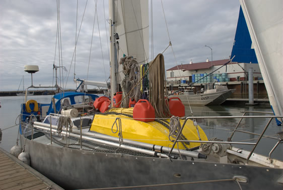 |
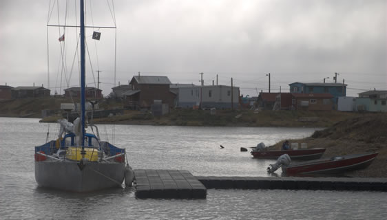
Winterizing begins - Nome Small Boat Harbour |